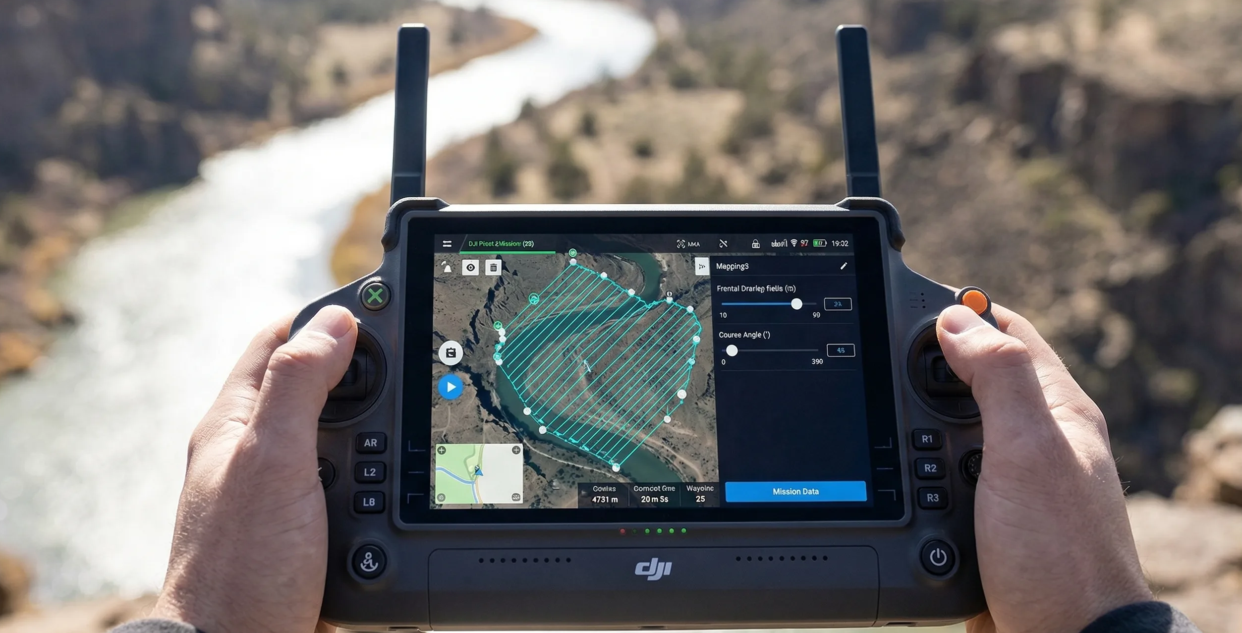
Sensor Planning
RGB Vs Thermal Vs Multispectral Planning
RGB, thermal, and multispectral payloads do not share one universal flight recipe. Learn how sensor physics changes altitude, overlap, speed, calibration, and what a useful deliverable looks like for each workflow.
Key Takeaways
- Sensor choice changes the mission objective, not just the file format or the image appearance.
- Thermal and multispectral workflows often need different altitudes, overlap assumptions, and environmental controls than RGB mapping.
- The best payload is the one that supports the required measurement, not the one with the longest feature list.
Sensor Choice Changes The Mission
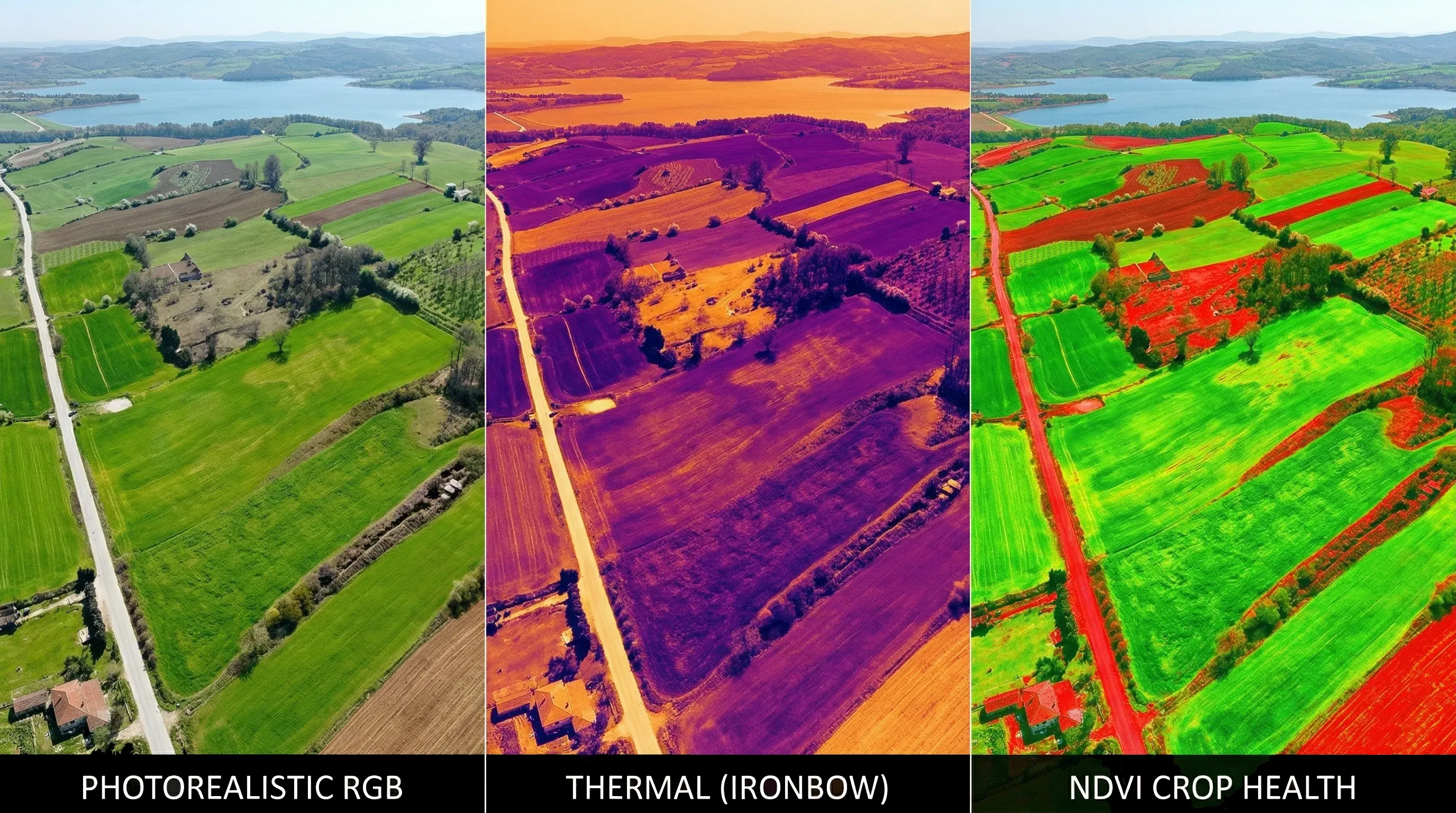
RGB, thermal, and multispectral systems are not interchangeable planning modes. Each one measures a different kind of signal, which means the acceptable altitude, overlap, speed, and field procedure all change with the payload.
This is why copying a successful RGB mission into a thermal or multispectral workflow is so risky. The same property can be flown by all three sensor families, but the planning logic for each mission may be completely different.
RGB: The Default
RGB remains the default for many mapping jobs because it supports orthomosaics, measurement workflows, and general visual interpretation. Modern RGB payloads also provide high pixel counts and strong geometric contrast, which helps tie-point extraction work efficiently.
That does not mean RGB settings are universal. It only means RGB is usually the easiest baseline for balancing visible detail against efficient flying height, speed, and capture load.
Physics Of Radiometry For Thermal Mission Planning
Thermal missions operate under a different set of expectations. Enterprise thermal payloads often work at native resolutions such as 640 x 512, which is a tiny image compared with common RGB mapping cameras.
Because the output is about temperature gradients rather than crisp visible edges, the scene can become hard for photogrammetry software to stitch. A field that would show abundant tie points in RGB may look like a low-contrast gray mass in thermal.
The usual response is to fly lower, slow down, and increase overlap significantly so the software has more geometric redundancy to work with even when the contrast is weak.
Narrowband Reflectance: Multispectral Mission Specifications
Multispectral mapping cares less about producing a visually attractive image and more about preserving band-to-band consistency. These sensors observe narrow wavelength ranges such as red edge and near-infrared so vegetation analysis can be derived from reflectance behavior instead of visible texture.
The critical constraint is radiometric consistency. If light conditions change sharply during the block, the reflectance relationships shift and the analytical value of the dataset falls even if the geometry still looks acceptable.
That is why multispectral flights are often constrained to stable illumination windows around solar noon and paired with downwelling light sensing or panel calibration before takeoff.

Real-Life Scenario: Precision Agriculture Against Solar Inspection
A single property can require two completely different flight plans. Imagine a site that combines agricultural land with a smaller solar installation.
- Thermal solar inspection: the mission may target minute temperature differences in panels, forcing low altitude, slow speed, and overlap in the 85/80 class so reflective low-contrast surfaces still stitch reliably.
- Multispectral crop analysis: the mission may tolerate a larger GSD because the canopy is the object of interest, but it becomes highly sensitive to calibration discipline, solar timing, and band integrity.
Both flights can cover the same geography, yet the altitude, overlap, and time-of-day logic should be different because the measurement problem is different.
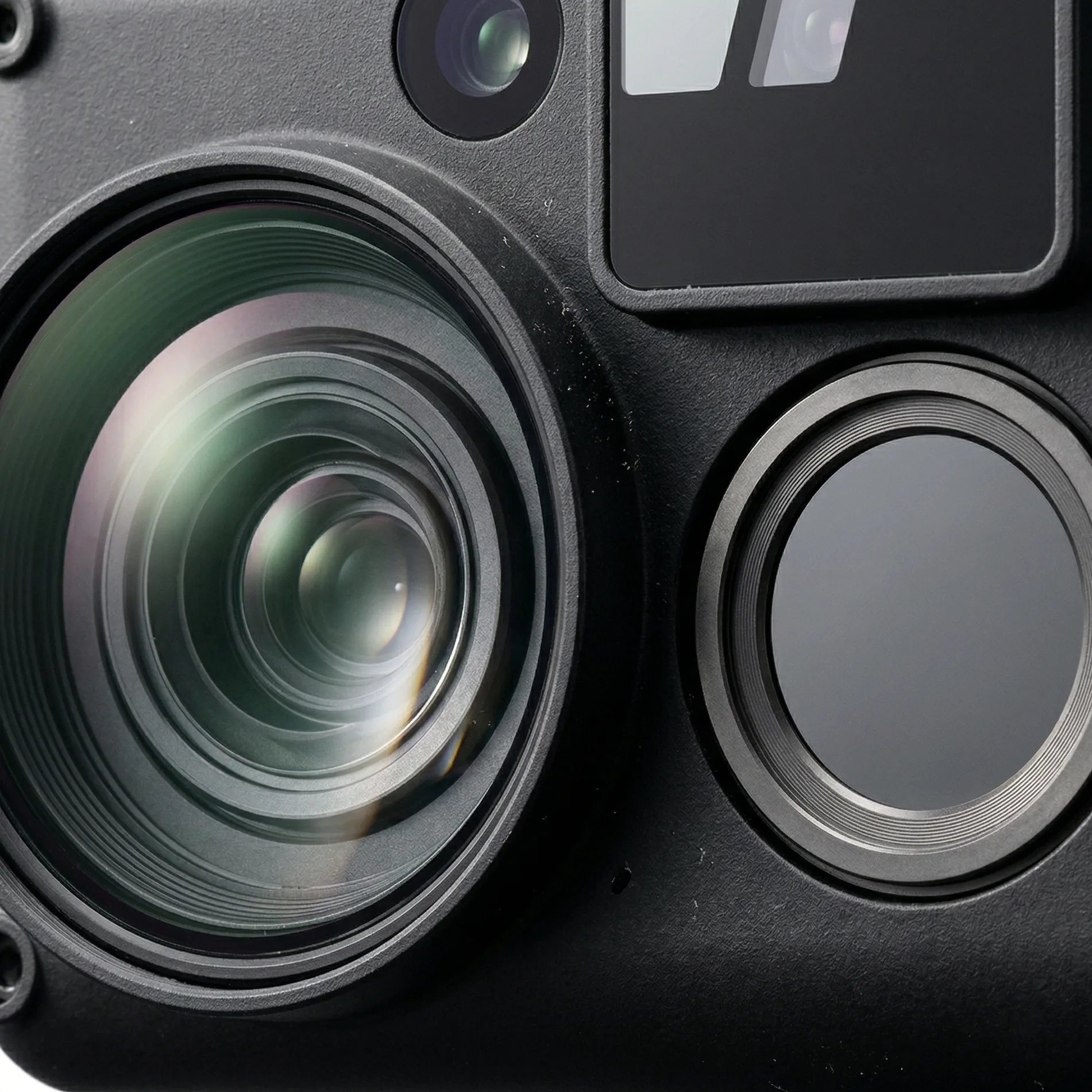
Hardware Requirements For Multi-Sensor Flights
Specialty sensors also change the support hardware around the aircraft. Multispectral payloads can create multiple files per trigger, while thermal datasets are often difficult to validate confidently on a dim field screen.
- Use media and storage fast enough to sustain the higher per-trigger data load of thermal or multispectral work.
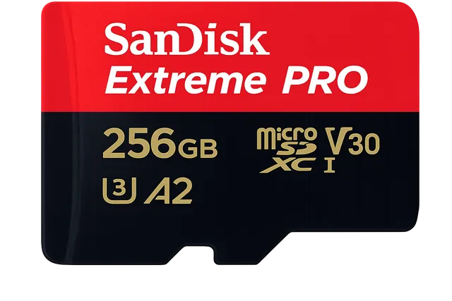
Flight Memory
SanDisk Extreme PRO 256GB
The enterprise standard MicroSD. Sustains 140MB/s write speeds to completely eliminate dropped frames during 0.7s interval grid mapping.
- Verify that field displays are bright enough to inspect thermal palettes and calibration steps in full daylight.

Field Display
TRIPLTEK 9 PRO Rugged Tablet
The undisputed enterprise standard for field telemetry. Pushes 1,300 sustained nits and refuses to thermal throttle so you never lose visibility in direct midday sun.
- Treat calibration and raw data review as part of mission planning, not as optional post-flight cleanup.
Operational Checklist: Flight Planning For Sensors
- Define whether the deliverable is geometric detail, radiometric temperature interpretation, or reflectance analysis.
- Calculate altitude from the actual sensor characteristics instead of reusing numbers from a different payload family.
- Set overlap for the signal quality of that sensor, not for habit; thermal usually needs more redundancy than textured RGB scenes.
- Check environmental timing, especially solar stability and calibration workflow, before committing a multispectral mission.
- Multiply total triggers by the sensor data load so storage and field backup capacity are sized for the real workflow.
Use the calculator with this guide
After reading the trade-offs, compare them inside the live calculator so you can see how altitude, overlap, route heading, and camera choice affect the plan on an actual mission footprint.
Related guides
Core Concepts
What Is GSD In Drone Mapping?
Ground sample distance sets the real resolution ceiling for drone mapping. Learn how to calculate it, where low-altitude planning backfires, and how to choose a target that matches the deliverable instead of chasing the smallest possible number.
Mission Planning
How To Plan A Photogrammetry Mission
Plan a mapping mission from the deliverable backward. This guide covers deliverable-first thinking, route geometry, margins, heading choices, corridor examples, and the preflight checks that keep the job physically executable.

Operations & Storage
How To Estimate Flight Time And Storage
Flight time and storage are mission constraints, not afterthoughts. Learn how tighter GSD, stronger overlap, and payload choice compound into more strips, more batteries, and larger backup requirements.