Guides Hub
Planning Guides
Actionable technical guides for professional drone mapping and photogrammetry missions.
All guides
5 guides

Core Concepts
What Is GSD In Drone Mapping?
Ground sample distance sets the real resolution ceiling for drone mapping. Learn how to calculate it, where low-altitude planning backfires, and how to choose a target that matches the deliverable instead of chasing the smallest possible number.

Overlap & Coverage
Front Overlap Vs Side Overlap
Front overlap and side overlap solve different reconstruction problems. Learn how each one affects alignment stability, strip count, storage growth, and failure risk over low-texture, reflective, or moving surfaces.
Mission Planning
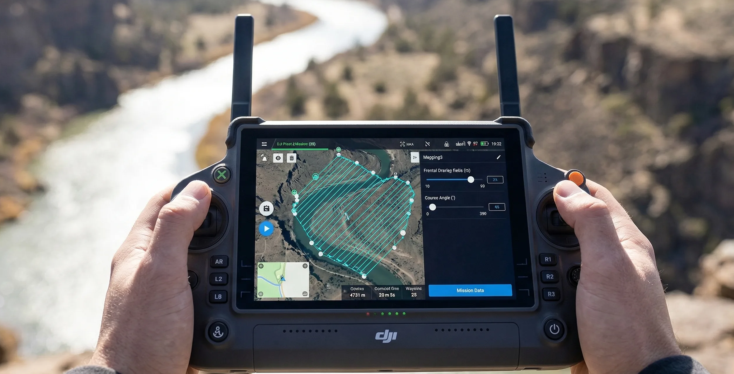
How To Plan A Photogrammetry Mission
Plan a mapping mission from the deliverable backward. This guide covers deliverable-first thinking, route geometry, margins, heading choices, corridor examples, and the preflight checks that keep the job physically executable.

Operations & Storage
How To Estimate Flight Time And Storage
Flight time and storage are mission constraints, not afterthoughts. Learn how tighter GSD, stronger overlap, and payload choice compound into more strips, more batteries, and larger backup requirements.
Sensor Planning
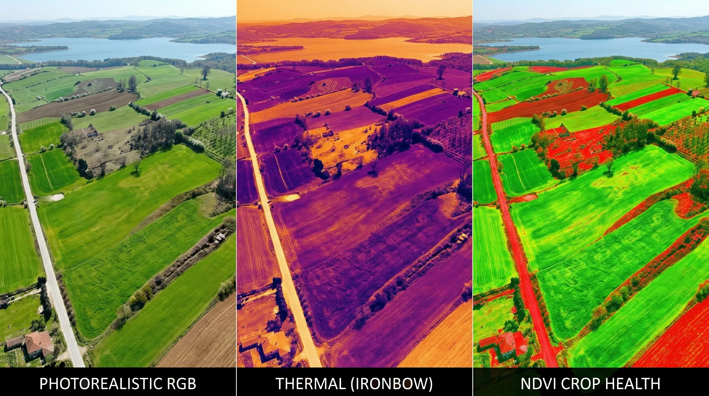
RGB Vs Thermal Vs Multispectral Planning
RGB, thermal, and multispectral payloads do not share one universal flight recipe. Learn how sensor physics changes altitude, overlap, speed, calibration, and what a useful deliverable looks like for each workflow.